


Flood hazard and flood risk maps
Flood hazard maps and flood risk maps (to be completed by 22 December 2013; updates every 6 years)
For areas with a potential significant flood risk the Member States will draft flood hazard maps and flood risk maps at river basin district level. These serve as means of information and basis when determining priorities for flood management.
The flood hazard maps comprise geographical areas which could be inundated according to the following 3 scenarios: floods with little probability or scenarios for extreme events, medium probability (corresponding to a return period of approx. one hundred years) and eventually floods with a high probability. For each scenario, extent of flooding, depth and water level as appropriate, runoff velocity or relevant flood runoff are to be represented in maps.
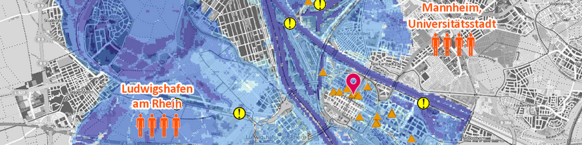
The flood risk maps represent potential adverse effects of floods, that is, the number of persons and extent of goods which might be affected by floods, for example: economic activities, agricultural acreage, transport networks, etc.,
Based on national and regional flood hazard and risk maps the ICPR has drafted the Rhine Atlas (Flood Maps for the International River Basin District ‘Rhine’). This atlas leads also to national cartographic portals.